Project and Drawing settings
In this section, comprehensive settings can be made for the project, the drawing, and the display. The project name, project number, and drawing number are fixed and cannot be changed afterward. However, you have the option to make adjustments to the location, date, and time zone information. Additionally, specific display settings can be defined within the project to optimally tailor the presentation to your requirements. These options allow you to precisely configure the project details and adjust the display according to your individual needs.
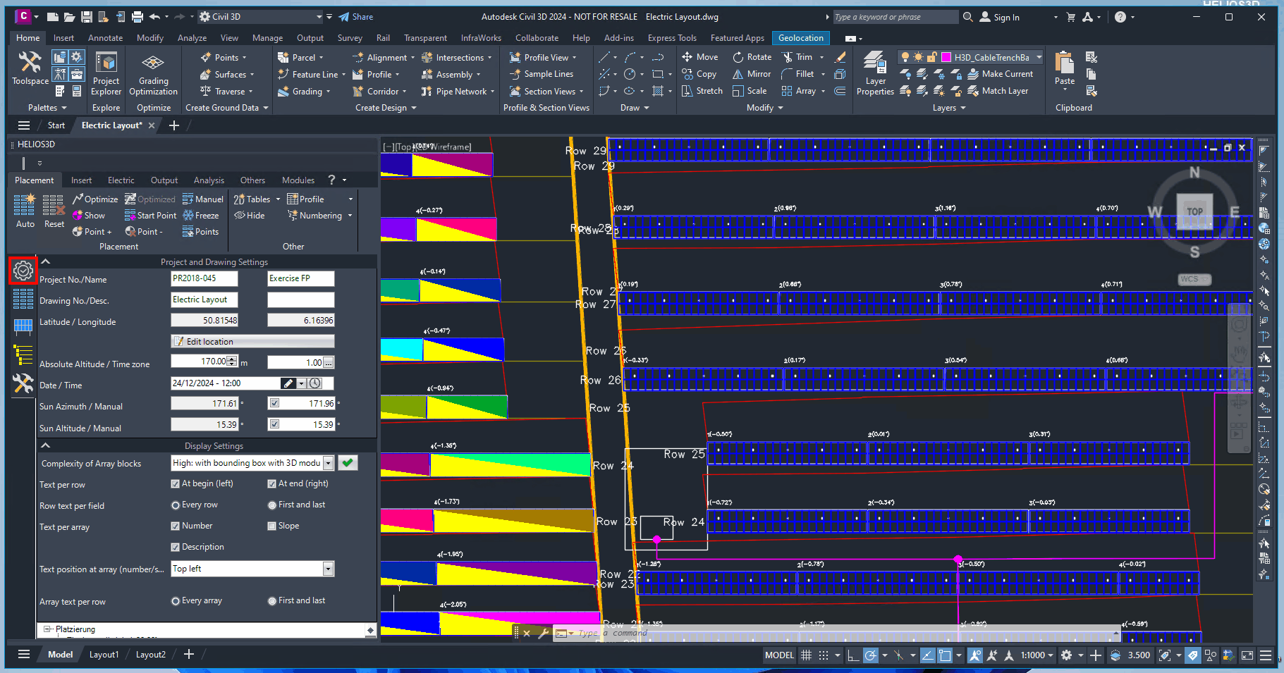
Section Project and Drawing Settings
Project Number
Project number this drawing relates to. If this box shows an ‚Unknown‘, the drawing is not correctly registered in the database, so no Helios functions will be available.
Project Name
Project name this drawing relates to. If this box shows an ‚Unknown‘, the drawing is not correctly registered in the database, so no Helios functions will be available.
Drawing Number
Drawing number of this drawing. If this box shows an ‚Unknown‘, the drawing is not correctly registered in the database, so no Helios functions will be available.
Drawing Description
Description of this drawing. If this box shows an ‚Unknown‘, the drawing is not correctly registered in the database, so no Helios functions will be available.
Set Latitude
Insert latitude for the project location. This value is used for calculating the sun’s position and by that the shadings.
The geographic location is completely independent from sun and coordinate system settings inside Civil 3D.
Set Longitude
Insert longitude for the project location. This value is used for calculating the sun’s position and by that the shadings.
The geographic location is completely independent from sun and coordinate system settings inside Civil 3D.
Change Geographic Location
Allows changing the geo position in a dialog, which supports GPS or UTM data. Alternatively, the location can be read from KML/KMZ files or the AutoCAD geo location settings.
This geo position is exclusively used for the calculation of the sun angles and it’s independent from geo referencing for the DWG file, which can just be managed by the user.
Geo position and surface
The dialog for changing the geo position for the calculation of the sun position and resulting shadow on the project settings page has changed.
A new search location field has been added that uses a web service to search for an address. When an address is selected, the GPS coordinates get read and a map gets displayed in the background of the drawing.
The map uses the UTM84 coordinate system.
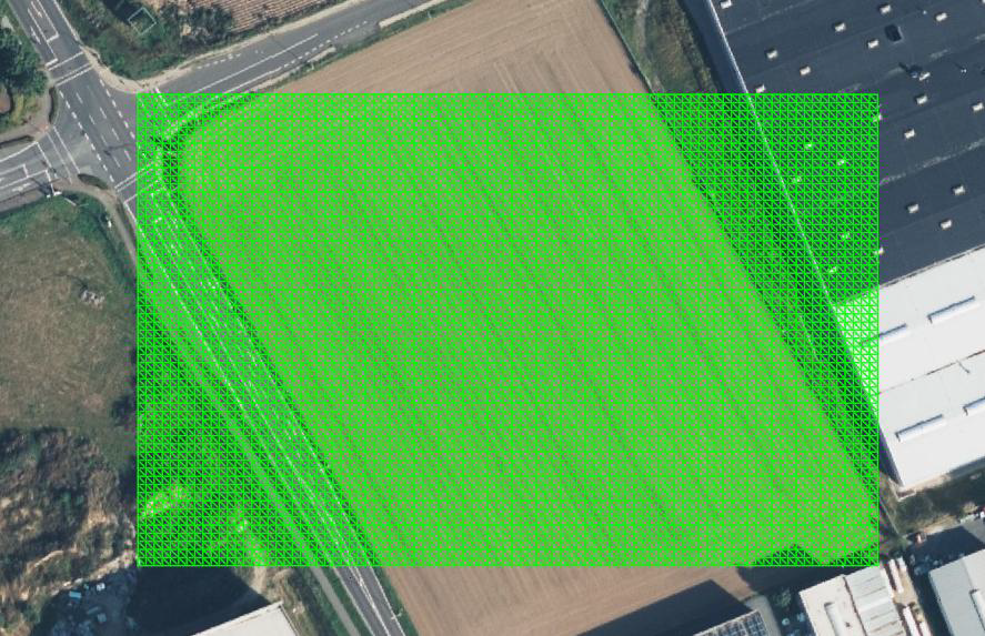
In the DTM / Surface section it is possible to optionally retrieve a free surface in UTM84 coordinates. This can be a compromise solution in case no better survey data are available, and at the same time it’s an alternative to the use of third party solutions such as Google Earth or Bing data.
In the upcoming dialogue you can change both values.
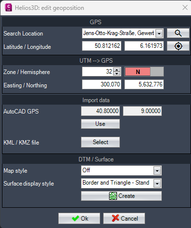
Search Location
Type in an address to receive a list of possible locations from the web. When a listed location gets selected, the background map of AutoCAD gets displayed with zoom to the location.

Zoom to location
Zooms to the selected location in case the user has moved around inside the drawing.
Retrieve a surface from the web
Users who don’t have access to accurate survey data or who like to avoid the costs can now retrieve free data from https://www.gpxz.io/. The resulting surface uses UTM84 coordinates and chooses the proper zone automatically.
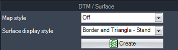
Map style
Sets the map style for the AutoCAD Map service for the drawing.
Surface display style
Sets the style the generated surface will be displayed with after insertion.

Starts the creation mode for importing a rectangular surface by showing the below prompt in the command line.
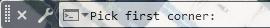
The user can pick the first corner of the area which immediately leads to the prompt below.

The result will be a rectangular TIN surface at a maximum size of 10 km². The surface immediately is ready to be used for creating a layout.
Absolute Altitude
Enter the height value for the absolute altitude. This value is used in the yield assessment and significantly affects temperature influences.
Time zone
Set the time zone for the sun’s azimuth and altitude based on the specified date and time. Incorrect time zone settings will render all shadow calculations inaccurate. Always use the local standard time.
Enter Date / Time
Enter the reference date and time for the shadow calculation. All relevant fields will be initialized with this value to ensure shadow-free placement.
| Sun azimuth and altitude calculations based on date and time follow the algorithm defined by DIN 5034. |
The button „date/time“ sets the date and time to the default sun settings. The standard reference date for the northern hemisphere is December 21st at 12:00 PM, and for the southern hemisphere, it’s June 21st at 12:00 PM.
These reference dates are not intended as recommendations for the chosen geographic position.
Azimuth (°) of the Sun
Azimut in degrees resulting from the current input in <Date / Time>, <Latitude> and <Longitude>. The sun position is calculated after DIN 5034 and has a range from 0 to 360 degrees, measured from north and clockwise.
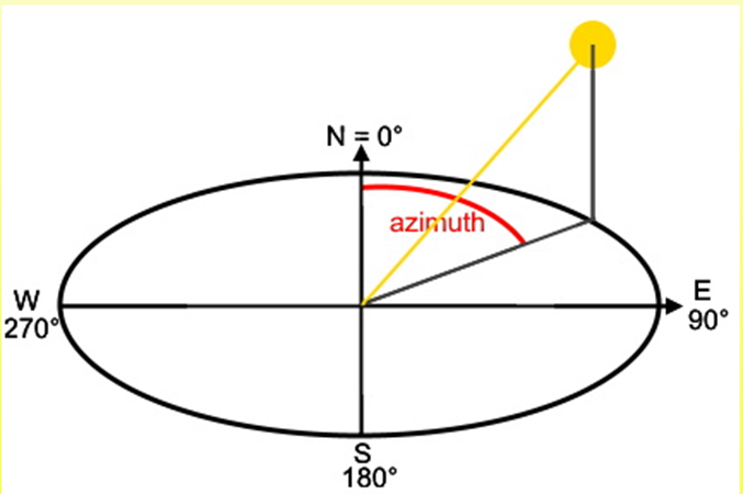
Overwrite sun azimuth
Enable to overwrite the sun azimuth calculated after DIN 5034.
Altitude (°) of the Sun
Altitude in degrees, which is calculated for the drawing from the <Date / Time>, <Latitude> and <Longitude> settings.
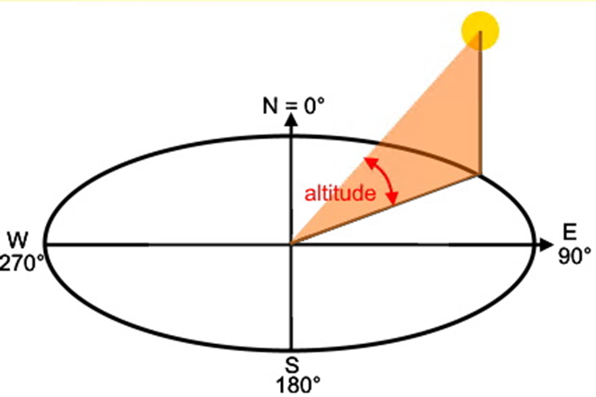
Overwrite sun altitude
Enable to overwrite the sun altitude calculated after DIN 5034.
Section Display Settings
All options, except for the complexity of array blocks, are applied to future table placement executions.
Complexity of Array blocks
Select the level of detail for the blocks in any table insertion and update all blocks accordingly. Reducing the block details improves performance without affecting functionality.
Check boxes and radio buttons
These checkboxes and radio buttons determine which labels are added during the placement process.